Introduction
 I've had the desire for an outdoor adventure of some type for a while. I thoroughly enjoy nature and getting off the beaten trail. As mentioned in my previous trip this summer, I've been preparing tactically and mentally for this trip for quite a while. Based on learning from the previous overnight trip in the Delaware Gap, I made a couple of equipment upgrades. The main item was to get a mummy sleeping bag that takes 1/4 the space of a traditional sleeping bag.
The trip that I planned was on the Delaware River from Hancock, NY to Frenchtown, NJ. This is a distance in river miles of about 160 miles. I've labeled where I stayed each night (Day 1, Day 2, etc) on the map. I studied the distances, read normal travel distances of others, and dovetailed this into available camping areas. The goal was to carry everything that I needed to complete the trip over 5 days. So I needed to travel light as I wanted everything to fit below the deck of my Wilderness Tsunami 145 touring kayak that I purchased from Backcountry.com
My inventory was as follows:
Camping
Coleman Hooligan 2 tent
Ledge Sports +20 Ultra Light Sleeping Bag
Camp essentials > Saw, Ax, knife, hand chain saw, collapsible shovel, waterproof matches, Vaseline soaked cotton balls, first aid kit, Camp Suds
Light: Head lamp, 2 flashlights (waterproof), Solar waterproof reading light
Tooth brush and tooth paste
Clothing
Long pants (Cotton for camp)
Nylon water pants
Waterproof boating jacket
3 long sleeve under Armour shirts
3 short sleeve shirts (hiking)
2 pair socks
2 pair underwear
2 swim shorts
Cutoff jean shorts (for camp)
1 pair of old sneakers and 1 pair of water shoe
Gloves (1/2 finger)
Hat
Sunglasses
Camp Towel
Other
Bailing pump and sponge
Partial Kayak Cockpit Skirt
Aqua-Bound Carbon Fiber Paddle
Spare paddle
3 battery backups
1 power block and 2 USB cables (micro and mini USB)
Waterproof camera and deck mount
Off
Water filter (Sawyer)
2 Clear 2 Go water filter drinking bottles
Vitamins
Food
Coffee (Starbucks Doubleshot Espresso - 6 cans)
Power Bar 6
Beef Jerky 3
Bag of Almonds
Dried Fruit 4 bags (2 Mango, 2 Raspberry)
Bagel 5
Salami (Gave up on meat restriction diet for a bit)
Day 1

The weather didn't look all that great as there was overcast and high probability of rain, but I was determined at this point to make the trip. This would be my last chance to do it in 2013 as the weather would get too cold before long.
 After Monday, the weather looked very favorable and I only had about 15 miles to go on Monday. So, I packed up all of the supplies into the van and we loaded the boat on top. Justine rode along so Judy would not have to drive back alone.
The Malone Downloader 2 roof racks were much easier to load the boat and seemed to be more secure for the 14 1/2 foot kayak. We hit speeds of 65 MPH without a problem on the interstates. We left Flemington just about 11 am for the 2.5 hour drive to Hancock, NY.
 By the time we traveled up to Hancock, we were all hungry so we stopped in the local Subway for lunch. Several people commented that my kayak was nice looking boat. Generally, Hancock seemed to be a friendly community as I chatted with several people while in line. After lunch, we headed to the river access point and unloaded the boat and supplies in a light rain.
Rain interrupted our unloading the van and packing the boat. The rain became really light so I completed loading the boat. I was happy to see that I had room to spare.
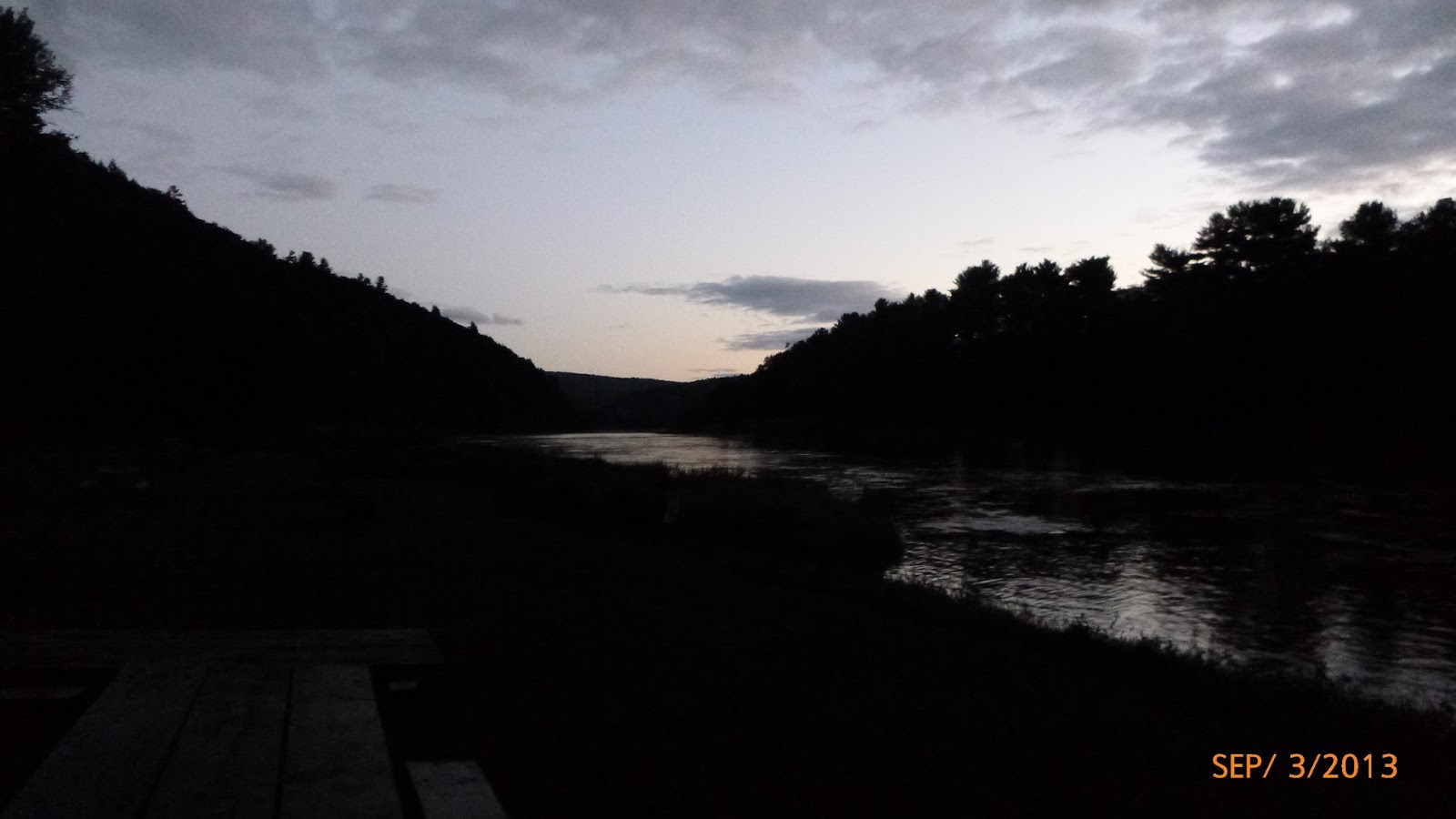
 So after a brief photo shoot and saying our goodbyes, off I went.
 As you can see, there was a slight foggy mist on the water as I headed downstream toward Soaring Eagle Campground. It was pretty neat paddling off into the fog with lots of expectations going through my head. One of which was hoping that I didn't get rained on...at least not a lot. We saw a fisherman who warned of potential thunderstorms passing through, but it looked like it would be minor to me.
 As I set out on the river, the fog started to lift. There were several threatening clouds that blew over and I even had a light sprinkle of rain. It was a bit cool but paddling kept me warm. However, the weather held out and actually improved as I passed down the river. I paddled for quite a while and realized that I was not seeing any people. There was some road noise off to my right on the PA side from the Hancock Highway, but I didn't see anyone on the river. It was a private river.
 There was a spattering of what I will call cottages along the river, but most didn't appear to be homes. They were more of 3 season cottages. I think between 2 p.m. and roughly 6 p.m. when I stopped I only saw one person (woman fishing) on the river.
 As I started down the river, I realized that bridges would be good way for me to track location and sort where I was as I traveled downstream. I think that I captured all but 1 of the bridges. During the trip I passed under 25 bridges including 3 interstate highways. The first bridge was the bridge at Lordville, NY.
The water was very smooth with almost no rapids on this section of the river. There were quite a few great photo opportunities.
One of the high lights was spotting a Bald Eagle sitting in a tree. Normally, I don't go back for pictures, but I made an exception in this case. I took many pictures, but most were marginal quality as my waterproof camera has limited capabilities. It is a low cost, compact camera with only 4x optical zoom. It does take pretty good video.
 I traveled down about 15 miles to Soaring Eagle Campground. I arrived just before the owner shut down for dinner for the night. I was arriving just as their season ended. The campground was pretty empty as most people must have left on Labor Day. It had a mix of RVs and campsites. There was one family tenting and one RV owner arrived later.
 I only paid $10 bucks to stay the night then went back to the river and pulled the boat up. The camp ground is on the PA side of the river just before Kellman's Bridge. There is a nice little cove just before the bridge where I accessed the campground and pulled the boat up. The campground was a family run operation and the bathrooms were clean, so I would recommend it.
 I was happy to find a spot on the campground with mobile coverage, so I sent text message to check in. I was able to quickly setup the tent. The campsite right next to me still had embers going in the fire and people had left some wood, so it was very easy to get the fire started. I was amazed that I was not really bothered by mosquitoes. I sat out on the picnic table and had my dinner. Dinner consisted of sliced salami on a roll with almonds and dried mango for desert. It seemed very good, but I probably was just very hungry.
 I replenished my water after dinner just about the time that it started to rain. Boy did it rain. We had very heavy rain all night. I got up at one point and pulled the boat farther up the bank of the river. I was concerned that the tent would leak, but fortunately the Coleman tent held up fine. I'm really happy with this tent. It is compact, not too heavy, works, and was only about $50. I just can't see paying $250 for a tent and another $200 for a sleeping bag. I paid under $100 for both and they worked fine for kayak camping.
Since I had already checked in, I went to bed early about 10 p.m. as I knew the next day might be a long one.
.JPG)

Day 2
 It was still raining when I woke up so I had one of my Starbucks coffees
to get going and headed up to the bath house. I saw the owner who
reminded me to get water from his facet at his house. He said it had
better flavor. I took him up on the offer and filled my 4 water containers. On the way back he pointed
out his apple tree and told me to take some Macintosh apples. I took 5.
They were small, but very delicious. The apples made a great breakfast as I floated down the
river. I was able to find a wireless connection and send text communications home. I was glad that I did because I didn't get another reliable connection until I was almost at Port Jervis, NY.
It was still raining when I woke up so I had one of my Starbucks coffees
to get going and headed up to the bath house. I saw the owner who
reminded me to get water from his facet at his house. He said it had
better flavor. I took him up on the offer and filled my 4 water containers. On the way back he pointed
out his apple tree and told me to take some Macintosh apples. I took 5.
They were small, but very delicious. The apples made a great breakfast as I floated down the
river. I was able to find a wireless connection and send text communications home. I was glad that I did because I didn't get another reliable connection until I was almost at Port Jervis, NY.
I had to break camp in a slight drizzle. The biggest negative was
that I had to put the tent up wet. The tent itself was dry however the rain-fly was soaked. I was able to get on the river just after 8:30
a.m.
 The river was definitely moving faster and was
up about about a foot over night from the rain. I encountered the first
set of rapids only a few minutes down after pushing off. The speed of
the flow and amount of water combined with the murky color was a bit
intimidating as I was on the river alone. It reminded me to tighten up
my PFD and that I wanted to be smart. On the entire trip, I generally tried to find the
safest passage through all the rapids vs. the
The river was definitely moving faster and was
up about about a foot over night from the rain. I encountered the first
set of rapids only a few minutes down after pushing off. The speed of
the flow and amount of water combined with the murky color was a bit
intimidating as I was on the river alone. It reminded me to tighten up
my PFD and that I wanted to be smart. On the entire trip, I generally tried to find the
safest passage through all the rapids vs. the  most exciting. I didn't
think it would be good to be in the water by myself with a water temperature in the mid 70 degree range.
most exciting. I didn't
think it would be good to be in the water by myself with a water temperature in the mid 70 degree range.  My
original goal was to get to Mastope, PA which was about 26 miles. I
had reserved a camp site at the Buckhorn Natural Area on the PA side,
but this was 48 miles from my start point which seemed an unlikely
distance for a day. From what I read on the internet, 25 miles was a reasonable distance to go every day on this section of the river, so I was looking at 2 days to get to Buckhorn.
My
original goal was to get to Mastope, PA which was about 26 miles. I
had reserved a camp site at the Buckhorn Natural Area on the PA side,
but this was 48 miles from my start point which seemed an unlikely
distance for a day. From what I read on the internet, 25 miles was a reasonable distance to go every day on this section of the river, so I was looking at 2 days to get to Buckhorn.
At Buckhorn, you are required to get a permit to stay over night
from the rangers. I wasn't sure the speed of travel so I had the
permit for 2 days but only one night. It is free, primitive camping (no
running water/facilities). The rangers told me that there were Black
Bears in the area and I had to hang my food. That didn't worry me as
much as the comment that people had seen rattlesnakes. I decided that
if I stayed there I would get there before dark as I didn't want to be
wandering around in the dark with snakes and bears.
The river was moving at a nice pace and I
 thought that I was making good
time. I didn't see any eagles or interesting wild life so I just
paddled on. The water was very dark so I was glad that I filled up my
water supplies. I didn't want to try to filter this brown water.
thought that I was making good
time. I didn't see any eagles or interesting wild life so I just
paddled on. The water was very dark so I was glad that I filled up my
water supplies. I didn't want to try to filter this brown water.  As
the morning went on it started to turn into a beautiful day. The USGS
gage at Barryville, NY was at ~4.3 ft which is slightly higher than
normal and just at the recommended level for "intermediate" boaters.
The air temperature was in the low 70's as well as the water
temperature..so it was reasonably safe weather conditions. I didn't
want to be in the water though as the boat was heavy with supplies.
As
the morning went on it started to turn into a beautiful day. The USGS
gage at Barryville, NY was at ~4.3 ft which is slightly higher than
normal and just at the recommended level for "intermediate" boaters.
The air temperature was in the low 70's as well as the water
temperature..so it was reasonably safe weather conditions. I didn't
want to be in the water though as the boat was heavy with supplies.I had a very scenic view as I went through the sparse number of communities along the river. I passed through Callicoon, NY and Cochecton, NY before reaching Milanville, PA. On the bridge at Milanville was ominous sign warning of the Skinners Falls Rapids. I heeded the recommendation and scouted the rapids before passing through. It seemed prudent based on my skill level and the high water. I actually scouted the river from both sides and was considering dragging the boat over the rocks to go around the rapid, but after observation, the right side looked passable. If I did end up in the water, the river was narrow with low banks here so I thought I could quickly get to the shore. It ended up just being a fast and fun pass through Skinners Falls (follow link to Youtube) as I only got wet from spray.
I headed down toward Narrowsburg, NY. This was the next landmark on my way. The river narrows here and gets very deep...hence the name Narrowsburg. The river gets to 133 feet deep here. I believe one hypothesis is there was an ancient water fall here. Anyway, after passing under the bridge, I pulled over at an access point a lunch. A fella came up in pickup truck and chatted with me for a while before I started on my way. He had one of those reflective vests on so not sure who he worked for. We both saw several fish there and he asked if I did any fishing on the route...maybe next time.

 I passed
through the rapids under the #9 Rail Road bridge and was getting near
Sylvania Tree Farm camp ground which was my planned stopping point for the night. I was relying strictly on my GPS as
there was not mobile service so I could not call them for directions.
I ended up seeing a camp site by the side of the river and pulled the
boat up. I got out and walked around. I found the bath house and lots
of campsites, but no office. No one was camping there on the day after Labor Day. After about 20 minutes I decided that I
should make a break for Lackawaxen which was the next town on the way as it was getting late in the day. I
remembered that there were several campgrounds in the area. Again, the
idea of going all the way to Buckhorn didn't seem feasible. I could
not imagine running rapids in the dark. The last think that I needed
was to hit a rock in the dark and take a swim.
I passed
through the rapids under the #9 Rail Road bridge and was getting near
Sylvania Tree Farm camp ground which was my planned stopping point for the night. I was relying strictly on my GPS as
there was not mobile service so I could not call them for directions.
I ended up seeing a camp site by the side of the river and pulled the
boat up. I got out and walked around. I found the bath house and lots
of campsites, but no office. No one was camping there on the day after Labor Day. After about 20 minutes I decided that I
should make a break for Lackawaxen which was the next town on the way as it was getting late in the day. I
remembered that there were several campgrounds in the area. Again, the
idea of going all the way to Buckhorn didn't seem feasible. I could
not imagine running rapids in the dark. The last think that I needed
was to hit a rock in the dark and take a swim.
 I really started paddling hard with sense of urgency. I think that I must
have breezed through the next 2 rapids (Masthope Rapids and Colang Rapids). I took
some water on as I was hit with a side wave exiting Colang rapid. I
keep paddling hard as it was getting very close to 6 p.m. I figured
that I only had a little over an hour of light. Next, I went through
Kunkell Rapids which was fairly rough. Again, I got wet with a side
wave. I was pretty much soaked with temperature starting to drop just a
bit. I was paddling so hard that I was not cold and started to dry
out. I knew from the GPS that I was getting close to Lackawaxen.
I really started paddling hard with sense of urgency. I think that I must
have breezed through the next 2 rapids (Masthope Rapids and Colang Rapids). I took
some water on as I was hit with a side wave exiting Colang rapid. I
keep paddling hard as it was getting very close to 6 p.m. I figured
that I only had a little over an hour of light. Next, I went through
Kunkell Rapids which was fairly rough. Again, I got wet with a side
wave. I was pretty much soaked with temperature starting to drop just a
bit. I was paddling so hard that I was not cold and started to dry
out. I knew from the GPS that I was getting close to Lackawaxen.I saw a fire on the left hand side of the river (NY) and paddled over. It was a Japanese family at a campground. One of the men helped me pull the boat out of the water as I was beat. They were really nice couple of families out for a camping visit from NYC. I quickly went to check in. Again the rate was only $10 for the night. I was the only other person there so I knew they had space. The camp ground (Ascalona) had a Barryville, NY address but was pretty far away from Barryville. It was owned by a retired couple from the Czech republic. I chatted with them both about my journey for a while before breaking away to make camp. He told me that he had kayaked the Yukon River. It sounded great (next?).
It didn't take long to setup camp and although the rain-fly was still damp, the tent was dry. I had a quick dinner of bagel and salami. Since I was very hungry, it was still very good. Dessert was dried Mango and Almonds. I ended up going to bed that night just after 9 p.m. Although at the time, I didn't like going on the extra 8 miles. This change of schedule setup the rest of the trip. I ended up doing 34 miles on the second day which made it feasible for me to target getting to the upper part of the Delaware Water Gap by Wednesday night.
Day 3

I heard the Japanese men up late at night several times as they conversed around their camp fire. I had gone to bed pretty early after the long day paddling with excitement of going through so many rapids. This was a much more lively river experience than I was used to on the middle Delaware River near my home. My expectation was that this would be even better. There is about a 12 miles stretch of the river that has multiple rapids and riffles.

Consistent with the previous day, I started off with my can of Starbucks espresso and then ventured out of the tent. It was just a bit cool with a heavy fog coming off the river. I'd noticed that while the outside of the tent was dry, the inside of the fly by the door was wet with condensation. So much for putting the tent up dry.
 I went ahead and had a light breakfast and broke camp. I put effort into cleaning off the bottom of the tent and used picnic tables to stage everything before packing the boat. I attempted to dry the rain fly, but with foggy overcast. I didn't get any help from the sun. Today, I put the fly in a garbage bag to keep everything else dry.
I was ready to push off just before 9:30 a.m. so I thanked the family for their help and wished them safe travels back to NYC. I shoved off just at 9:30.
 I only went around a slight bend and there was Lackawaxen. It had to be less than a mile so I was surprised how close I was to the town. Lackawaxen's claim to fame is really for 2 items. First, the Roebling's Delaware Aqueduct and second for Zane Gray home. John Roebling built the Brooklyn Bridge roughly 20 years later, but this bridge was a suspension aqueduct. It was built in 1849 to carry coal barges across the Delaware River and is the oldest wire suspension bridge in the U.S. Barges were raised and lowered ~30 feet with locks to traverse the river on the aqueduct.
  Zane Gray was best known as an author although he was also a dentist. He wrote novels about the west. I've never read any of his works, but he did sound like an interesting character. Just as I passed by his house, I briefly had mobile service. It was not long enough to send out a text message. This was not good as I knew the family would be worried since it was already 24 hours since my last message. This gave me extra energy to paddle through the day as I envisioned a State Trooper or Park Ranger tracking me down since I had not reported in. In hind site, I should have hiked up to one of the towns and tried to find a spot where I could get a
 connection. My bad and lessons learned.
 I paddled under the aqueduct through a small riffle. The day was turning out to be a beautiful day with temperatures in the mid 70's again and clear skies. I was listening to my marine radio tuned into the NOAA channels and they had mentioned a cold front coming in with potential for rain. I saw no evidence of this as I paddled downstream.
 I was enjoying my self paddling along admiring the scenery and breezing through the rapids that I found my self forgetting to take pictures or video. I will attest that this was the most exciting part of the Delaware. If I were to recommend a 2 day trip, it would be from Milanville, PA (mile marker 295) to Matamoras, NY (mile marker 256). This is generally moving water except for a bit around Narrowsburg, NY. Lackawaxen would be a good midway point (~18 miles) if you wanted to stay over night or you could go down to the Buckhorn Natural area and stay for free, but that is another 15 miles. You would then have a short paddle the next day.
All of the rapids were great. I passed first through Cedar Rapids which was at a wide part of the river. I had a little trouble as I miss read where the channel was but since the water was up, I only lightly hit a couple of rocks. The next major rapid was Shohola Rapids just south of the Barryville/Shohola Bridge. This rapid went on for a long time and had probably the greatest number of large waves. You can get a little bit of the feel of these toward the end of the video link above.


While the next major rapid was a few miles away, this section of the river continued with many short, unnamed rapids that kept things fun. In many sections, you could visually see that you were "going down hill" so to speak. At the bottom of that hill, you knew that there was potential for activity as the mass of water bottomed out.


 My plan was to have a light lunch at the Buckhorn Natural area. It was only 15 miles from my starting point, so it was much too soon to stop. I did want to carefully (remember mention of rattlesnakes) check out the area. I passed under the Pond Eddy Bridge and per the Range's map, meant that I was less than a mile from Buckhorn. I had looked at it using Bing and Google maps, so I was very sure where it was, but I did look for the details the Ranger provided.
  I went through Stairway Rapid which appeared to be mainly a series of rock rifts that spanned most of the river. I was so focused on looking for markers that I made a couple of mistakes, but was able to recover. I scraped over a rock and dropped off a pretty big drop at one point...big at least for me anyway. There is a large rock outcrop on the right just after the rapid. This is where the access is to Buckhorn. There is even a small sand beach to pull up on and you can have lunch on the rock with rapids whisking by. I have cut a picture from Bing Maps and highlighted the spot.
The milestone on the river is Monguap Island just before Monguap Rapids. The instructions were to go right of the island as their was an Eel Weir on the left where a boater could get caught up. Going through the rapids, I was trying to stay right (per instructions) and didn't see a rock and got hung up a bit. There was more trouble with another large rock so when I freed myself, I paddled quickly to the left and avoided a large ledge. It was all fun though.
 After this, there were several long rapids including one by Hawk's Nest and another near Mill Rift around the rail road bridge. The Mill Rift rapid in particular had quite a few large waves and it seemed to go on for 1/4 of a mile. Interestingly, this was where I saw the first people on the river since Narrowsburg which is a distance of about 30 miles. The people were a group of rafters dressed in traditional Chinese clothing which I thought odd for a rafting trip. They were not wearing PFD either...not good.
 After this point, the river became wider with less rapids, but the water was still cooking along. As I approached Matamoras, I had a mobile connection and quickly checked in. Judy was very nice about the long delay in contacting her. I had coverage for the rest of the trip. I passed through Matamoras, under the Port Jervis / Matamoras Bridge. People in Matamoras had patios right on the river. They also had numerous no trespass signs.
 Next
the river made a hard right just before passing under I-84. At this
point, there was a restaurant that advertised water side dining. I
thought about asking if I could get a burger to go, but it looked too
upscale since I hadn't showered in a couple of days. Anyway, I had been
about 30 miles with 10 to go. I was staying in primitive camping
(free) in the Water Gap and wanted to setup before it was dark.
Next
the river made a hard right just before passing under I-84. At this
point, there was a restaurant that advertised water side dining. I
thought about asking if I could get a burger to go, but it looked too
upscale since I hadn't showered in a couple of days. Anyway, I had been
about 30 miles with 10 to go. I was staying in primitive camping
(free) in the Water Gap and wanted to setup before it was dark.I paddled past Milford, PA and approached Namanock Island where I planned to stay. To my surprise, there was a large group there of either a camp or school as they looked like Junior High age. There were no spots left so I had to go on.
 I paddled on to Sandyston, NJ and found a site. The river was still up, so I didn't have a good spot to beach the boat. So I partially unloaded it and dragged it up about 30 feet to the camp site. The camp site was great. The primitive camping on the PA side does not have any facilities. Some of the sites on the NJ side have limited facilities although all the ladies in my family said "eew gross". It is much better than the alternative in my opinion. Someone had even recently raked and cleanup up the camp site. It was in excellent condition. I quickly setup camp, put up my bear hang, and cut wood for the night. My third day of having bagel's with salami was not good. I'd had enough of that. I hoped for a better dinner the next night. No more Salami.
 Day 4

 I splurged and had 2 Starbucks as it looked like I was going to have excess since the trip probably was going to end a day early. I had 1/2 a bagel and power bar. I ended up throwing out the rest of the salami as 3 days in a row was too much already.
I went down to the river with my Camp Suds to wash up. Fortunately, the water temperature was above the air temperature and I quickly washed up. Next I changed into paddling gear and broke camp. It seemed that I was starting later and later every day as I didn't launch until 10 a.m.
 Just before I started down the river, the part of group that had taken the island camp sites had passed me by. I over took most of them before rounding a bend to see the bridge at Dingman's Ferry. At this point, I decided it was prudent to ensure I know where I was camping tonight as I had good mobile service.
 I tried to stay at Delaware Campground in Delaware, NJ but I think their focus is RV camping. They close the office at 5 p.m. I thought it was unlikely that I could traverse ~40 miles by this time given my late start and probably that the river was slowing down. Also, the river flattens out and becomes 200 yards wide in places in the Water Gap making it difficult to find the fastest channel.
Fortunately, I had strong data signal as I did a Bing search and found Driftstone on the Delaware Campground. I called them and they were open until 9 p.m. although I obviously didn't want to be on the river at that time. It did give me flexibility as it was light enough to paddle until at least 7:30 p.m. They gave me directions so I went ahead to Dingman's Ferry. I made brief stop to empty trash and use facilities before getting back on the water.
 Since I new exactly where I was trying to stay, I just had to make a big push to get there. I did have other potential options at the lower half of the water gap, but I wanted to make it to Driftstone as this would setup the last day to get home.
 I was now paddling along the route Justine and I had taken in July. It was quite a bit different from our previous trip though. Although the water did go down over night, it was still considerably higher that the previous trip. I was moving along at a good pace, but none of the small rapids that we went through in July were visible. It was big flat water. This was a bit of a let down after the previous two days.
 I can't truly complain about going through the Water Gap, but it started to feel more like civilization than the upper Delaware. It is quite beautiful. The upper Delaware officially ends at Port Jervis and the river loses some of it's primitive feel. The change is from seeing one or two people per day on the river, to one or two people every few miles.
This part of the river was familiar. I passed the location in Peters, NJ where Justine and I camped and shortly later Smithfield Beach where we were picked up. I was definitely making good time.

 As I followed the river as it meandered around several islands, I saw
what I initially thought was a Black Lab playing in the river on the
right. I went over in that direction, but didn't see an owner. It was
about then that it sat down on its butt in the water to observe me. At this point, I saw a light brown snout and it had its tongue hanging out and I realized that I was looking at a Black Bear. I reached for the camera to remove it from the mount and quickly focused as best I could. At this point, the bear was spooked and took off. I did get a picture but didn't have time to zoom or really let the camera focus. All you can see is something black with the splash as it ran up the bank. It watched me briefly from the bank, but then shot into the under brush. I will have
to say this was definitely the highlight of the day although I did see
my second Bald Eagle about 30 minutes later.
As I followed the river as it meandered around several islands, I saw
what I initially thought was a Black Lab playing in the river on the
right. I went over in that direction, but didn't see an owner. It was
about then that it sat down on its butt in the water to observe me. At this point, I saw a light brown snout and it had its tongue hanging out and I realized that I was looking at a Black Bear. I reached for the camera to remove it from the mount and quickly focused as best I could. At this point, the bear was spooked and took off. I did get a picture but didn't have time to zoom or really let the camera focus. All you can see is something black with the splash as it ran up the bank. It watched me briefly from the bank, but then shot into the under brush. I will have
to say this was definitely the highlight of the day although I did see
my second Bald Eagle about 30 minutes later.As I approached Shawnee Island I spoke to a kayak fisherman who told me that I was only about 2 to 2.5 miles from the gap. I knew this area as I-80 runs along the river for a bit and there is usually some rapids along this area.
 After paddling for ~5 hours on what seemed like flat
water this was encouraging news. I picked up the pace and passed by
Worthington State Park on the NJ side. The river must have been 250 to
300 yards wide at this point. An occasional head wind was slowing me
down.
After paddling for ~5 hours on what seemed like flat
water this was encouraging news. I picked up the pace and passed by
Worthington State Park on the NJ side. The river must have been 250 to
300 yards wide at this point. An occasional head wind was slowing me
down. I rounded a bend and saw the remains of an old bridge. Only the pilings were left standing in the river. I knew that I was just entering the gap and finally I could see visually that the river was narrowing and it was going down hill. Around the next bend, I saw I-80 and a long set of small rapids. Paddling instantly became easier and I was speeding up. I think that I had less than 10 miles to go with about 3.5 hours of good light left. Piece of cake.
  I cruised under the I-80 bridge and was fully into the gap. This is truly beautiful area. The pictures with the sun casting symmetric shadows on the water were spectacular. The only negative and it is a big one in my opinion, is I-80 road noise. It was very loud from all of the trucks creating an echo in the gap. This is basically an end to the National Park. After this point, it started to change even more to a developed feel. Don't get me wrong, it is still a pretty area.

I started to hit a few more rapids. They caught me off guard a bit as I didn't expect anything significant until Foul Rift south of Belvidere, NJ. They were nothing major and a lot of fun, but I just didn't expect it and I got splash with some side waves. The air temperature was lower so it was not entirely pleasant to get wet.
In all honesty at this point in the trip, I was anxious to find my campground. I didn't want to miss it as there were not alternative places to stop. This would have not been good. I called Driftstone and got future directions. I think that I was just miscalculating how far that I'd gone on the water.

 I was less than 1/2 mile from the campground so I put one final push and was there pretty quickly. I pulled the boat on the ramp and was greeted by one of the owners. He was a fellow kayaker (although more advanced) and said he had done the trip a few years ago.
 I did my check in ($10 for the night) and picked out the campsite. I just wanted something close to the water as I didn't want to leave the boat unattended or have to carry it a long way. He walked down to the campsite and helped me pull the boat up. The boat was heavy with all the gear, but we got it up the embankment. I asked the guy how long the campground had been there and he said his parents started it over 40 years ago. He also gave me advise on getting through Foul Rift. Now this guy was a "Creeker". These people go down feed creeks into rivers after heavy rain. You can see a Youtube example here. Anyway he told me that Foul Rift should not be an issue at current water levels on the Delaware as well as path through the rapids.
I really like this campground. For one thing, they had food and chocolate milk which was a real treat as I had not had anything fresh to eat for days. The bathrooms were immaculate and each site had electricity and water.
A cold front came in and by the time I had setup camp, I could see my breath. I believe that it got down to about 45 degrees over night. I didn't start a camp fire but instead had light dinner with my chocolate milk. I checked in with the family and went to bed. Tomorrow would be the final push.
Day 5 - The Final Leg
 I woke up early at around 7:30 a.m. Initially, I thought that I might get an early start. I broke camp and laid the tent out to fully dry as it still had some wet sand stuck to the bottom. I went to bath house for a nice hot shower which was FANTASTIC. I felt refreshed and ready to go. I also was sure to void negative comments from the crew picking me up in Frenchtown. Did I say the shower was FANTASTIC?
I had a light breakfast consuming the last of my Starbucks. I consumed my last 1/2 bagel and packed the rest of my food in the nylon mesh compartment of the splash guard. I must say that at this point, I felt that I had not prepared enough different types of food. Two eggs over easy would have been great.
 Although I started early, I wasted time
and lost some time drying out the tent so I didn't hit the water until
10 a.m. I was still apprehensive about going through the notorious Foul
Rift. These rapids drop ~22 feet over about a 1/2 mile. The banks are
high on each side of the river so if you hit the water you are there
for a bit.
Although I started early, I wasted time
and lost some time drying out the tent so I didn't hit the water until
10 a.m. I was still apprehensive about going through the notorious Foul
Rift. These rapids drop ~22 feet over about a 1/2 mile. The banks are
high on each side of the river so if you hit the water you are there
for a bit.
 I remember the guidance from the night before. "Stay right of the island and you can either go through the large wave or around on the right or left. Then work your way back to the center of the river. Most people get hung up on the rift that traverses the entire river. Their boat gets stuck and they get separated from it and they have to swim. You have to find a way through it although at this water level it should not be a problem." I was sure that the advise was good, but wondered if I should take further assessment since it came from a radical kayaker that was 1/2 my age. He told me that he didn't scout any of the rapids including Skinners Falls and Four Rift. He only scouted the wing dam at Lambertville, NJ.
 Anyway, it was a beautiful day and I paddled toward Belvidere. I made it in no time. I was quickly under the bridge and knew Foul Rift was less than 1/2 mile away.
 As I approached the rapids at Foul Rift, the noise level rose with the sound of white water. I was surprised to see a fisherman part way down with his boat anchored. I was wondering if I was at the right spot.
 Neither the less, I worked my way to the right as I saw an island that looked mainly flooded. The rapids didn't look bad at all as I passed through the channel to the right of the island. I didn't even see the wave (which I was going to try to avoid). So I paddled back to the main channel and went directly through without a hitch. I could not even see much indication of the rift across the river. I kept looking for it for probably another 1/2 mile as I stayed alert. When I passed the power plant, I knew that the last major excitement sans seeing the family in Frenchtown was done.
  I had a decent paddle to get to Phillipsburg. I believe the distance is about 10 miles. It had some mini rapids, beautiful scenery, and industrial areas (2 power plants). Overall, the water was moving and I enjoyed the trip. The number of fishermen and other people on the river increased. I passed a young couple in a canoe as we passed through a series of homes on the river. The change was definite in that the majority of the homes along the river were in fact homes vs. vacation places. On the upper Delaware, this model is reversed.
I did see my third Bald Eagle on the trip just as I spotted the Phillipsburg Truss Bridge. It was interesting to see one so close to an industrial looking area. I tried to get the camera out before it flew off but failed miserably. I have a Panasonic waterproof camera that doesn't have a view finder. This is a major liability in open sunlight.


I approached the old truss bridge in Phillipsburg. I wanted to take some video but I couldn't tell how much battery that I had left on the camera. I cruised under the truss bridge and the suspension bridge. Off to the right was the dam where the Leigh River enters the Delaware. There were several railroad bridges as well. The last indicators of Phillipsburg passed by and I entered a more quite area again. There were only four major milestones to go: (1) I-78 Bridge, (2) Roebling Bridge in Riegelsville, (3) Milford Bridge, and (4) Frenchtown Bridge. I had 20 miles to left to home.
I knew most of the rest of the trip would be completed by the paddle. There were virtually no real rapids on the rest of the trip. The water was moving, but you don't get the burst of adrenaline and speed from a rapid.

I was anxious to see the family so I left the GPS on so that I could try to establish and to keep a cadence. I wanted to get to Frenchtown before 7 p.m. I also wanted to have a hot meal.

I passed under I-78 rather quickly. I sent a text to home letting them know where I was and confirming that I was going all the way to Frenchtown. I gave a rough ETA of 7 p.m.
It took longer to get to Riegelsville. I had a nice view of the Roebling bridge from the water. After Riegelsville, I think there was only one rapid. This coupled with fading strength and energy made the trip to Milford seem to last for ever.


Once I passed under the bridge, I got some renewed energy. I sent a text to the road crew and told them to start in about 10 minutes to get me. It was only about another 10 minutes when I saw the Frenchtown bridge that I said "come now".
I passed under the Frenchtown bridge about 6:45 p.m. I was able to empty the boat and pull it 1/2 way up the embankment before Judy and Jill arrived to get me. It was a fantastic trip full of excitement, beautiful scenery, and wild life. It was great to see the family though.


Closing Thoughts
This was a great trip. I enjoyed all of the upper Delaware. I tried to follow the "leave no trace". The only exception was that I lost the top to one of my water bags. The trip gave me time to think. Much of the land is marked "Posted" as it is private along the river. The major exceptions are Buckhorn Natural Area and the Delaware Water Gap. I didn't trespass on people's land although I did think about Woodie Guthrie's song "This Land is Your Land".
As I went walking I saw a sign there
And on the sign it said "No Trespassing."
But on the other side it didn't say nothing,
That side was made for you and me.
For some reason, this song just kept popping in my head as I paddled along.
I'd like to see more areas like the Delaware Gap and Buckhorn Natural Area. It would be great to have this along a lot of the major water trails. I know the Susquehanna has a section lined with public lands for primitive camping.
I did have a few lessons learned on items to bring and things to do differently.
Full Spray skirt for Kayak - Stop deck wash in rapids
Bring Kayak Cockpit cover (keeps out bugs over night)
More diverse food and do some cooking
Plan stopping points (multiple options in advance > This isn't like driving up I-95)
Stop to setup camp earlier.
Camp rake to get rid of sticks
Extra battery for camera
1 additional battery backup (10,000 mAh)
1 additional power block
Sun screen
1 cotton shirt for sleeping
Wow, great trip!!! Thanks for all the details. I may have to try this next year. I have a 16' Old Town Cayuga touring kayak that I haven't gotten to do any touring in yet. This looks like an ideal trip and you laid it all out for us :)
ReplyDeleteThanks again and keep paddling,
Karl
Thanks Karl. It was a lot of fun. I learned a lot. The over nighter that I did in July was my only prep for the trip.
DeleteI think the Cayuga would work well and you certainly should be able to carry enough gear.
This was my first trip, but I have been looking at other local rivers. No dams is a plus for the Delaware. It was great to break away for a few days. It has a nice mix of rapids and cruising water with decent flow on the upper sections. I enjoyed the upper Delaware the most, but the Gap was good too. The free primitive camping in the Gap is great. South of Belvidere the river feels like the areas that I paddle in often so it was not quite as special.
Scott
What type of kayak did you use. It looks like Pungo 140? I'm thinking of buying that kayak soon.
ReplyDeleteIt is a Wilderness Tsunami 145 (14 1/2 ft). It did very well in the rapids on the upper Delaware, holds a reasonable amount of gear, and was good cruiser.
DeleteI read a lot of reviews. In the end, price was a big factor as well. I was able to get it on sale.
If you are thinking about kayak camping, check the storage capacity on the Pungo. I was able to keep all my camping equipment below deck which minimize the wind drag.
Pungo looks like it has nice feature of water bottle holder. This is missing on the Tsunami. I have one on my Olde Towne Loon 120 and I miss it on the Tsunami.
DeleteThanks for your comments and I would love to do one of these trips next year.
ReplyDeletea good info...
ReplyDeletenice posting :D
visit us at Muaro Duo + River Trip
thanks
Epic trip! Nice pictures. I'm planning a trip from Worthington Campgrounds to Frenchtown. It will be the first time I've ever done kayak/camping. From your blog, it looks like it took you about 1.5 days for that distance. Was the river running fast at that time? I'm trying gauge approxmately how long it would take. Thanks! -Roy
ReplyDeleteThanks. The overall distance should be very attainable, however, as I am sure you know, there are more limited opportunities for "legal" camping along this stretch of the Delaware. The place (Driftstone) that I stayed the last night is roughly 10 miles from Worthington so you would be left with ~40 miles for day. I think the river was running fairly fast as most posts that I read suggest 25 miles is a good day paddling on the Delaware. Based on my discussion with the guy at Driftstone Campground, low water at Foul Rift would be your biggest concern on this part of the river as you don't want to get caught up on the rift that runs across the river. I went back and looked at USGS gage height at Frenchtown and it was ~2.5 feet. Belvidere only has discharge rate, so I would check the flows. I think 40 miles in a day is a push if the flows are low.
DeleteMy son and I have been completing sections of the Delaware the past 3 years. Our next adventure is Belvidere NJ to Frenchtown NJ. In your opinion, what is more challenging, Skinner's Falls or Foul Rift? I checked the USGS gauge at Belvidere and it is currently 3500ft3/sec discharge and 4.1ft height. When you went through Foul rift it was 5000ft3/sec and 4.7ft height. We have small kayaks (Old Town Otter Plus, 9.5ft) We have done the entire Upper Delaware from Hancock and got through Skinner's Falls fairly easily, although we were a little concerned. ANy additional advice for the Foul Rift? Thanks in advance
ReplyDeleteHi, It is recommended to scout Foul Rift from the Observation Deck in Martins Creek Land Management Area. I loaded this deck location on Google Maps. You can hike in easily. I've never been through either of them when they were issue. I understand Foul Rift is supposed to be the second most challenging/dangerous after Wells Falls at Lambertville. Foul Rift is mainly an issue at low water levels as strainers get caught up on the rocks and make it more difficult/risky. I always follow the original directions from the manager at Driftstone on the Delaware campground which are listed in my blog.
DeleteNot sure how old your son is, but if you hike in to the observation deck you should be able to see if there are strainers and identify best route through. It might not be an issue at these water levels.
Good luck. Safe and happy paddling!
Scott: I am the author of A Paddler's Guide to the Delaware River, working on a 4th edition. I would be interested in using one or more of your great photos. Please contact me at bluecano1@yahoo.com. Thanks, and see you on the river! -Gary Letcher
ReplyDeleteGary, Your email is rejecting. Scott
Delete